
Industry
GIS / Spatial Intelligence
Role
Lead UX Designer
Period
2020–2026
Collaboration
Product · Engineering · Government Client
GIS Product Design System
Maps are where spatial work begins
Tudou Data's GIS products were not designed around a map alone. They were designed around the work people needed to complete with it. I organized fragmented natural-resources, surveying, and business data into a spatial product system for judgment, analysis, collaboration, and delivery.
The case follows five connected actions: understanding spatial data, organizing specialist analysis, standardizing reusable tools, bringing spatial judgments into workflows, and closing the loop in risk-response scenarios.
01 / FORM A JUDGMENT
Turn complex spatial data into a judgment
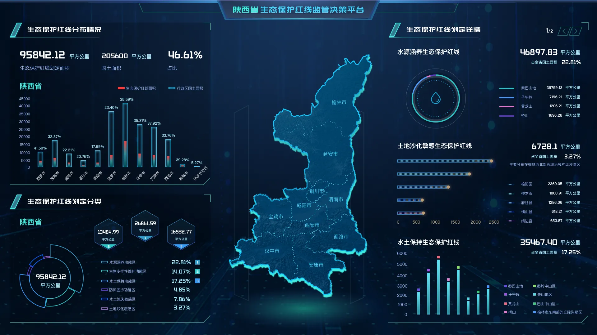
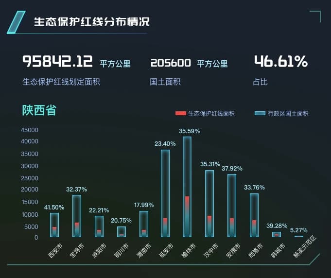
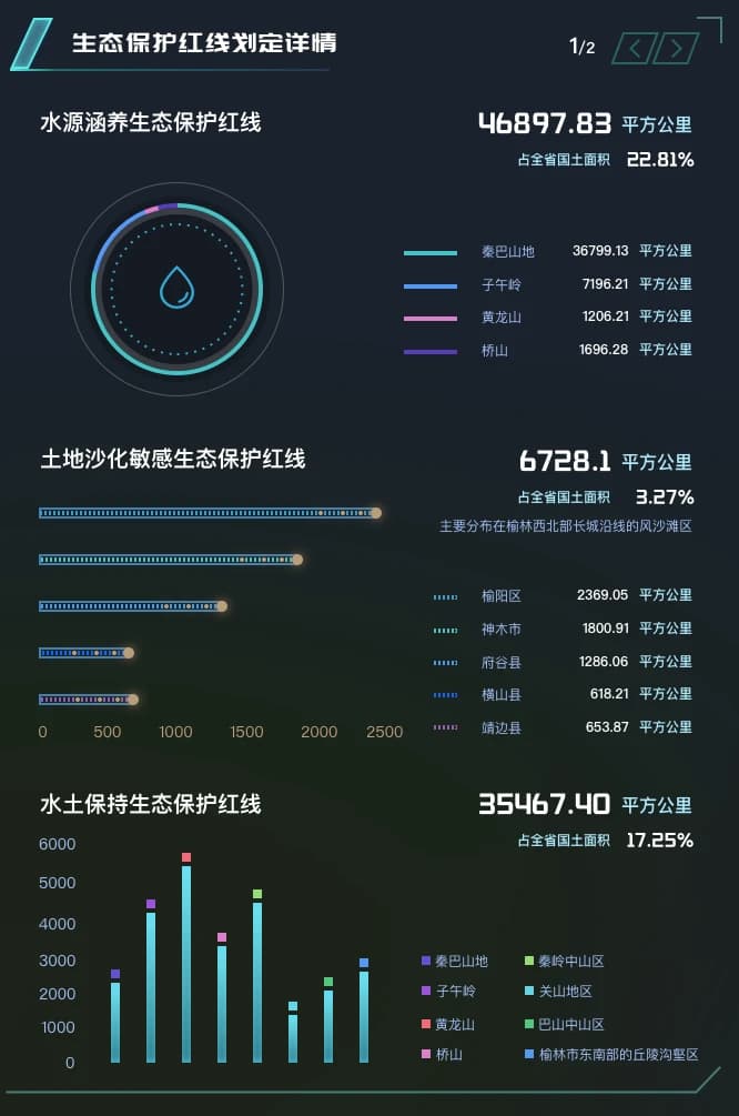
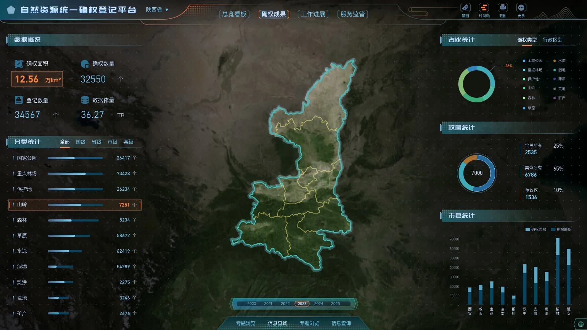
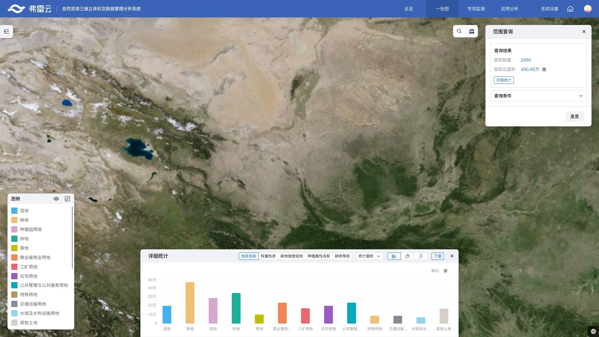
For cross-region and multi-type natural-resources data, users first need to see the overall situation and regional differences. Classification, metrics, and object details then trace the question back to a concrete spatial result. Maps, statistics, and object information form one path from a broad judgment to a specific outcome.
02 / ORGANIZE AND ANALYZE
Turn the map into a professional workspace
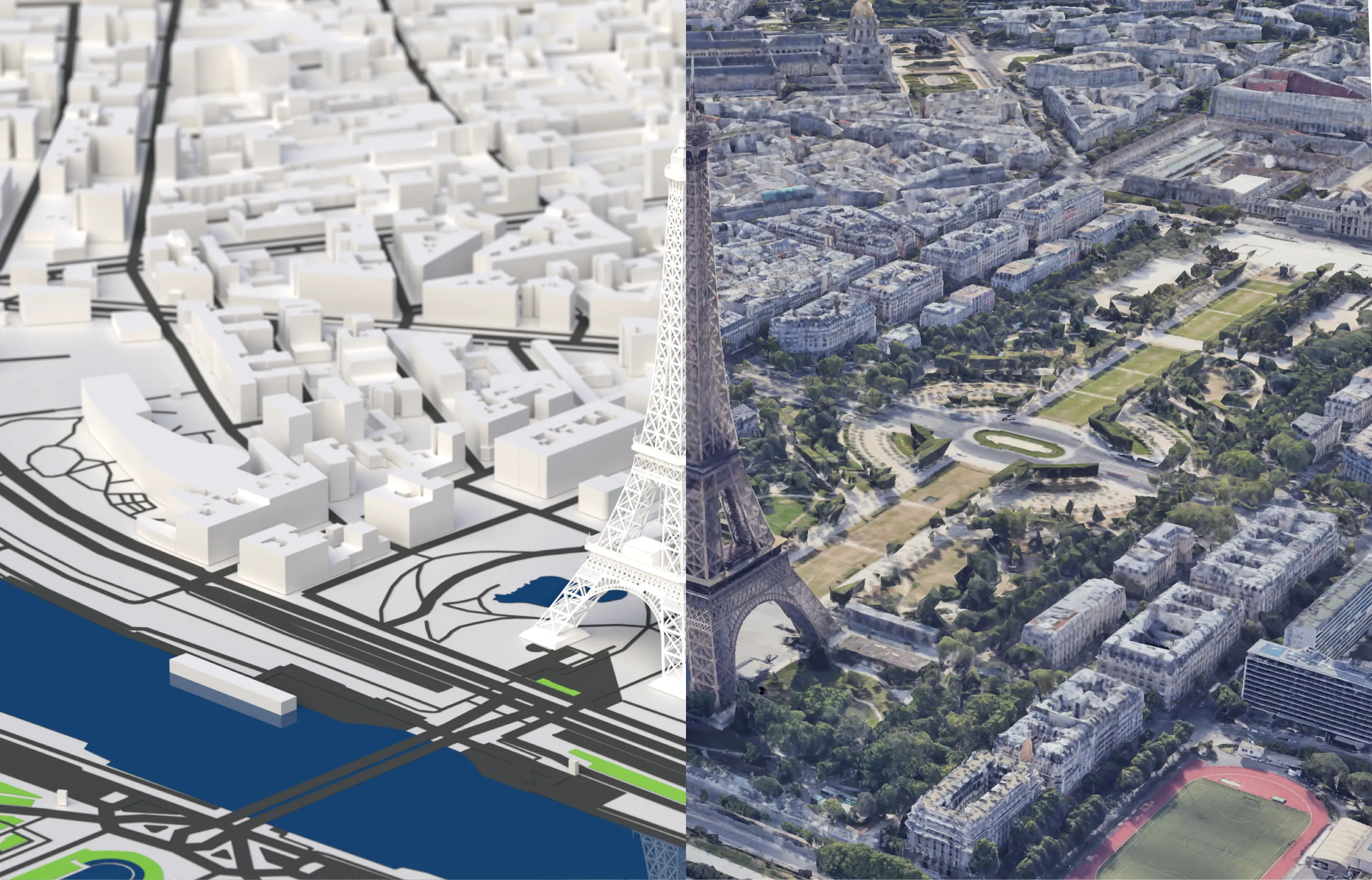
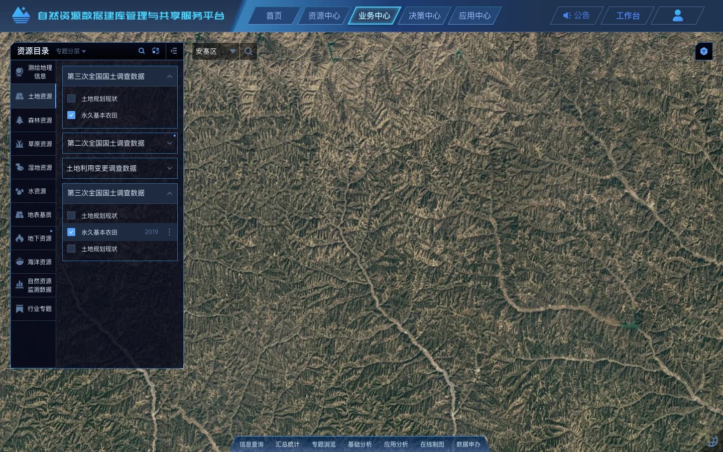
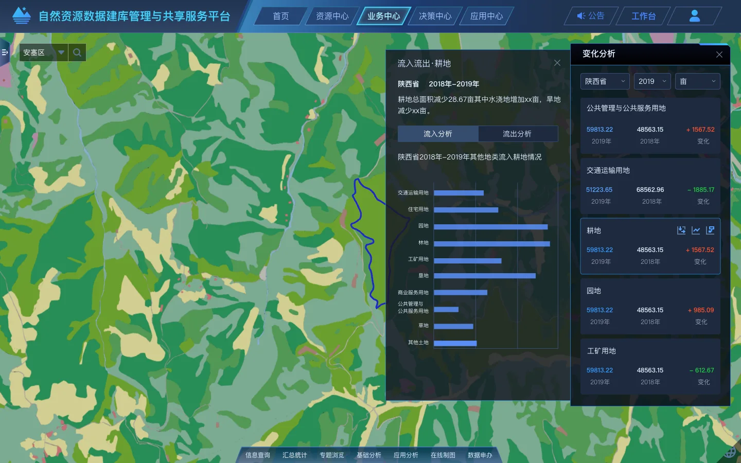
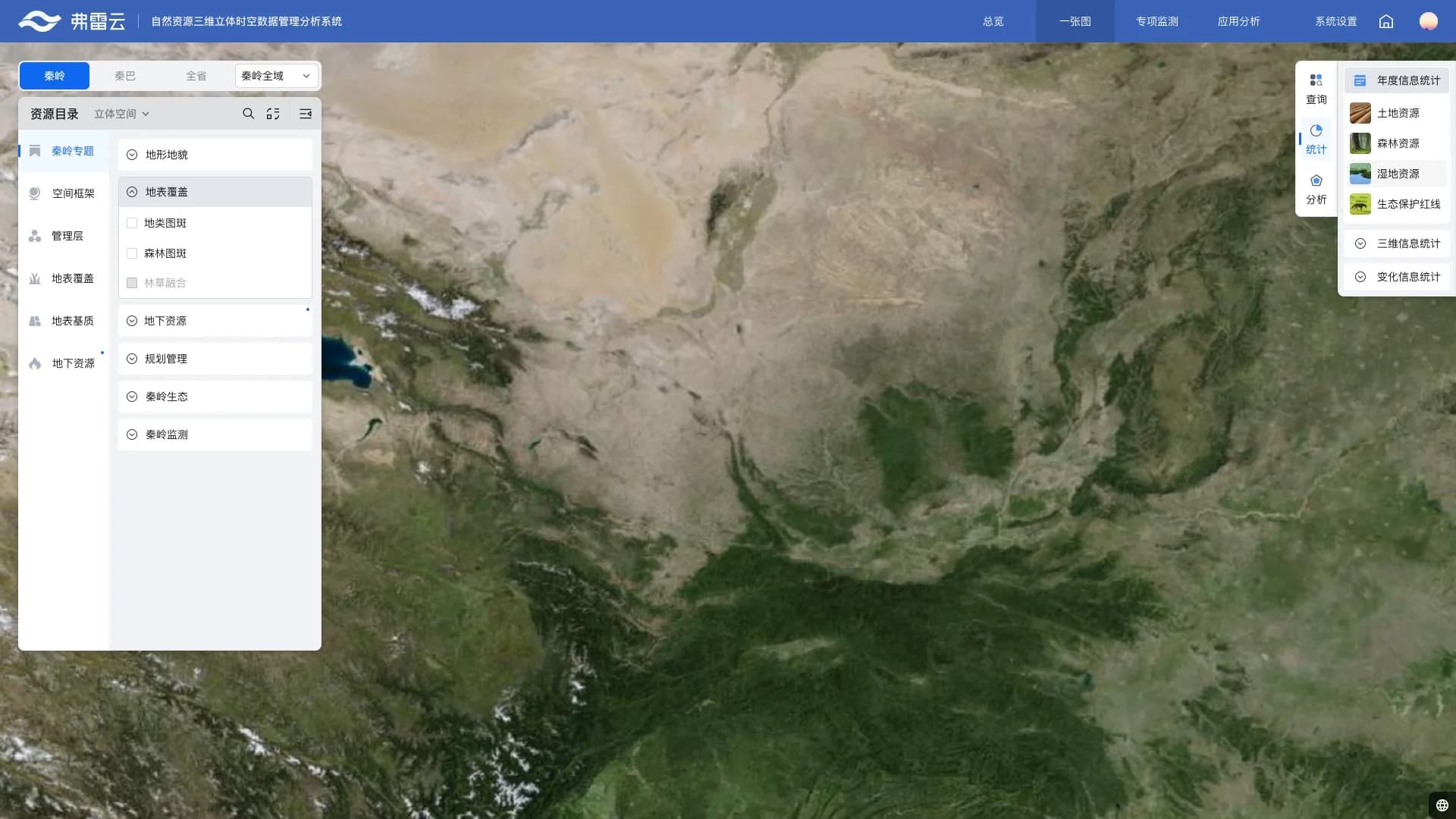
Specialist users need one work surface for choosing data, changing views, defining an area, and reaching explainable results. Resource catalogs, spatial queries, real-scene context, and change analysis appear as the task calls for them, so map actions lead to an actual analytical judgment.
03 / TOOL SYSTEM
Standardize specialist capability into tools
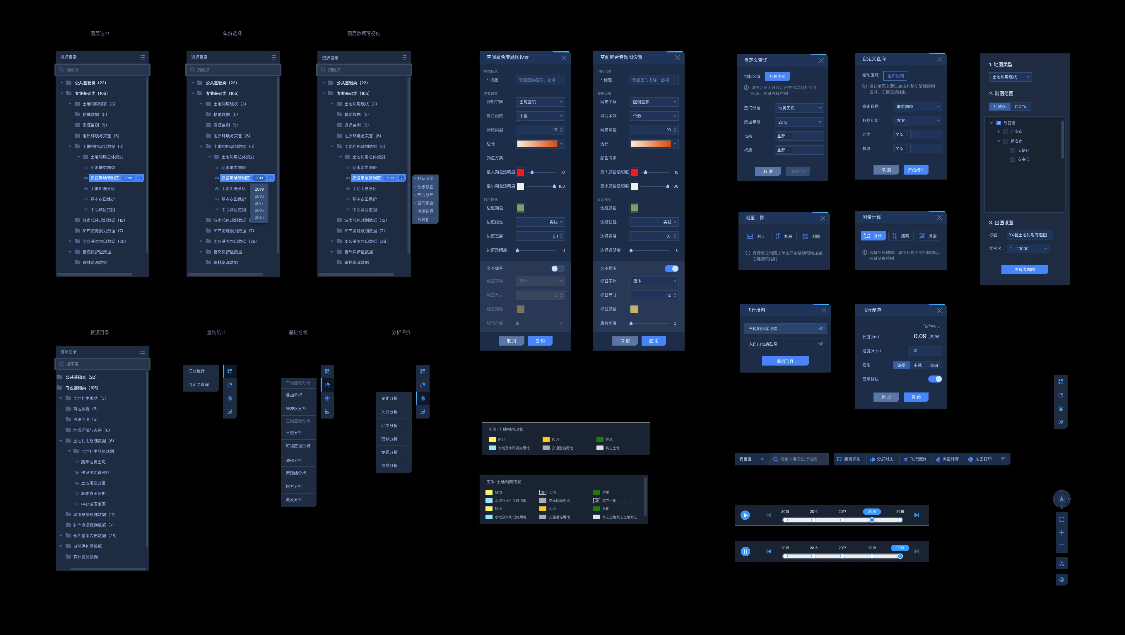
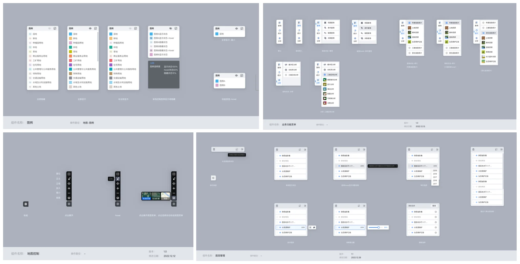
GIS complexity cannot be re-explained in every project. Standardized layers, legends, queries, measurement tools, timelines, and map controls create a consistent operating language that can be reused across 2D, 3D, and thematic work.
04 / BUSINESS WORKFLOW
Bring spatial judgments into a workflow
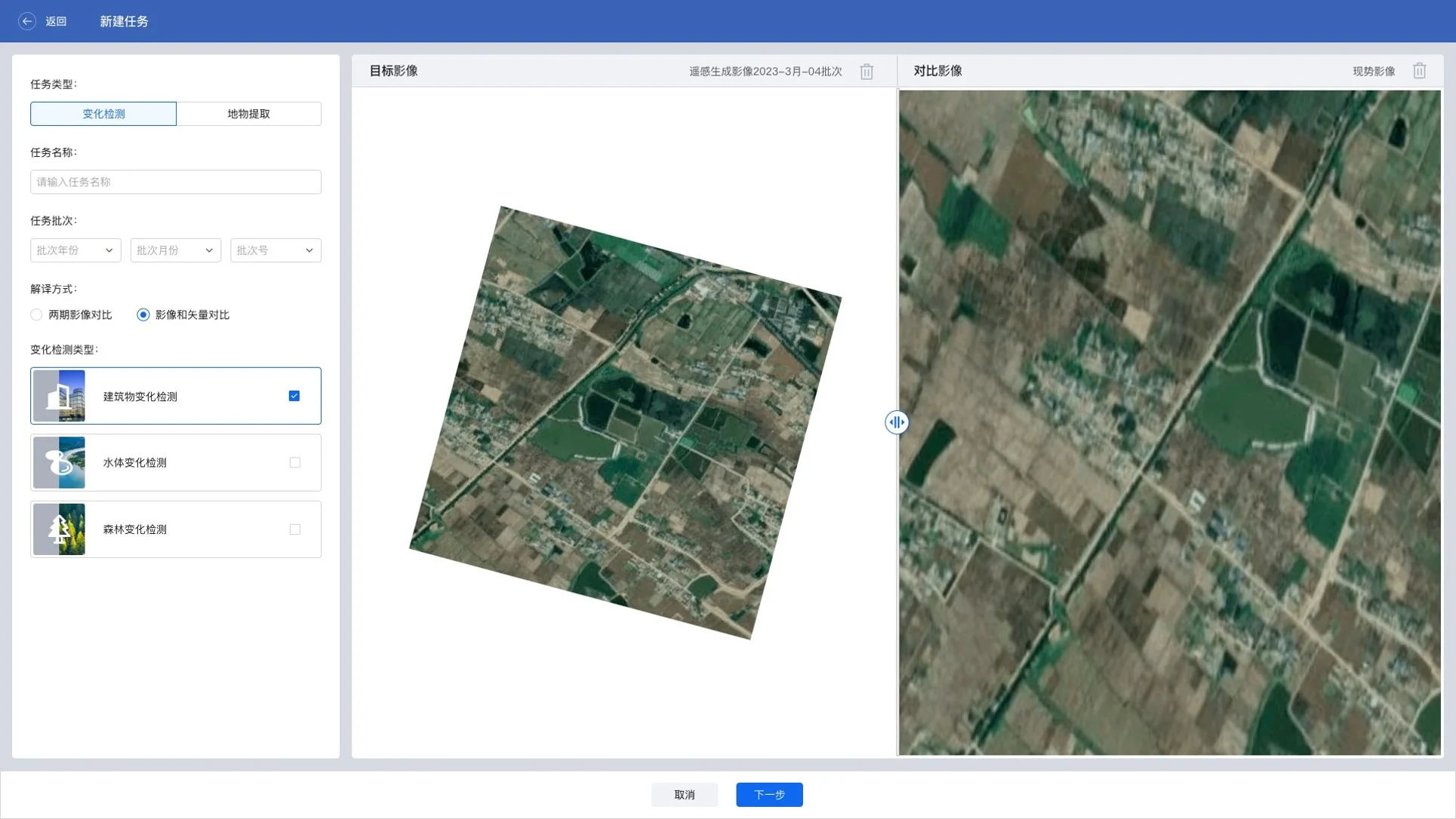
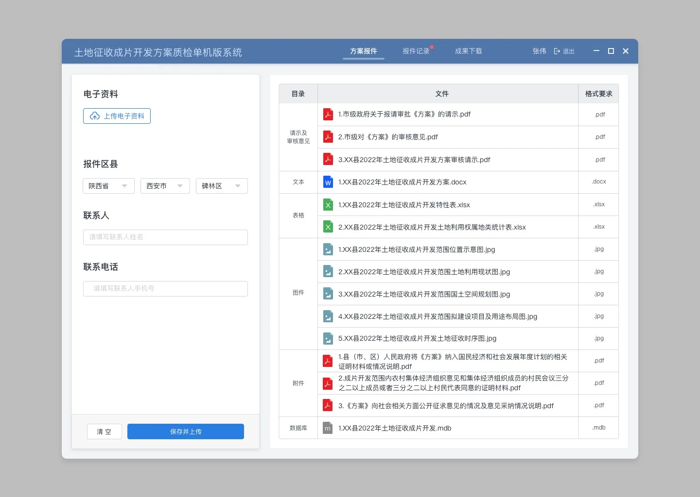
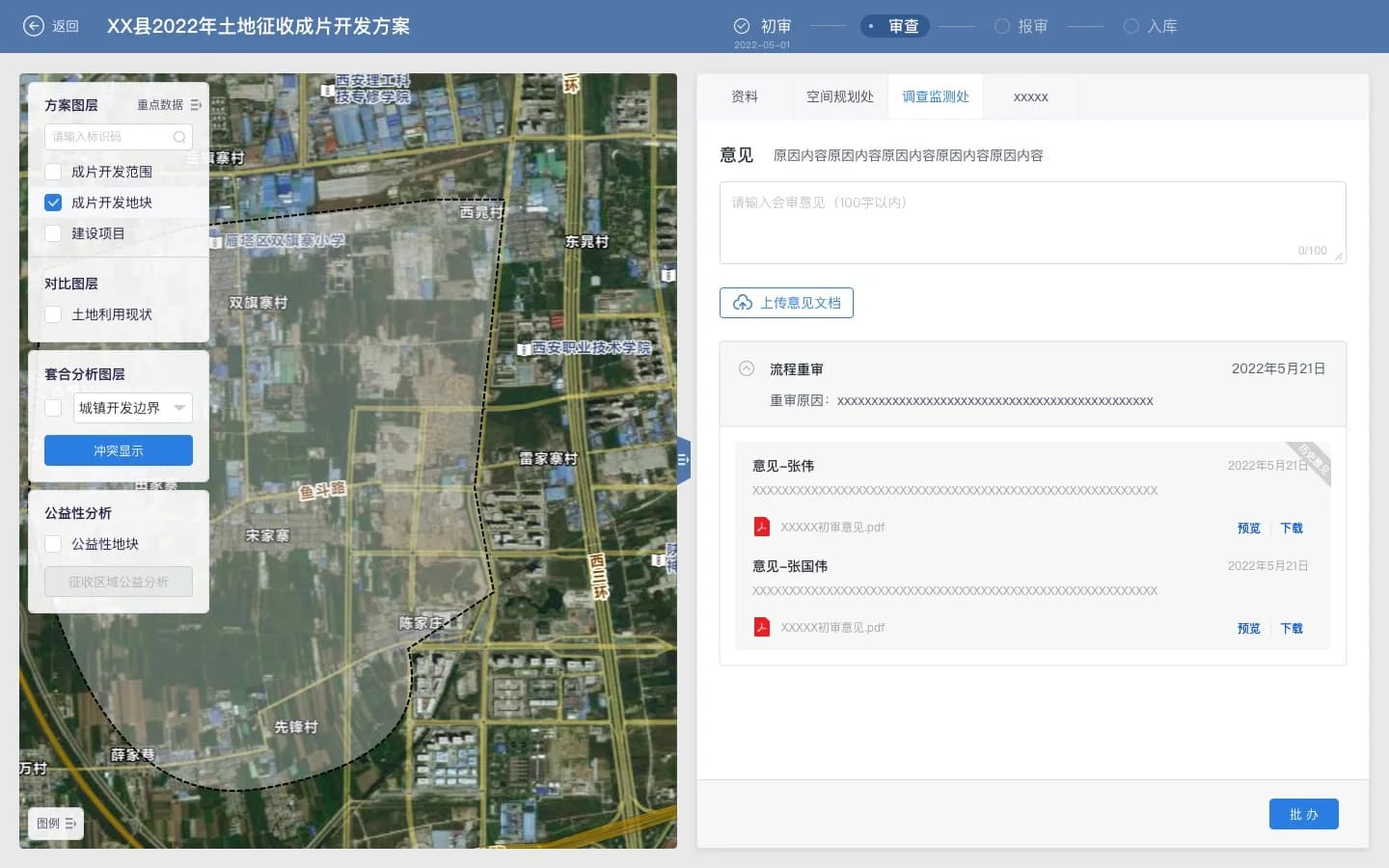
Spatial analysis has to be submitted, reviewed, and recorded. Image comparison turns change detection into a defined task, while land-acquisition development brings extents, materials, conflict analysis, and departmental feedback into one workflow. The map supports formal handling, not just inspection.
05 / RISK RESPONSE
Carry risk discovery through response
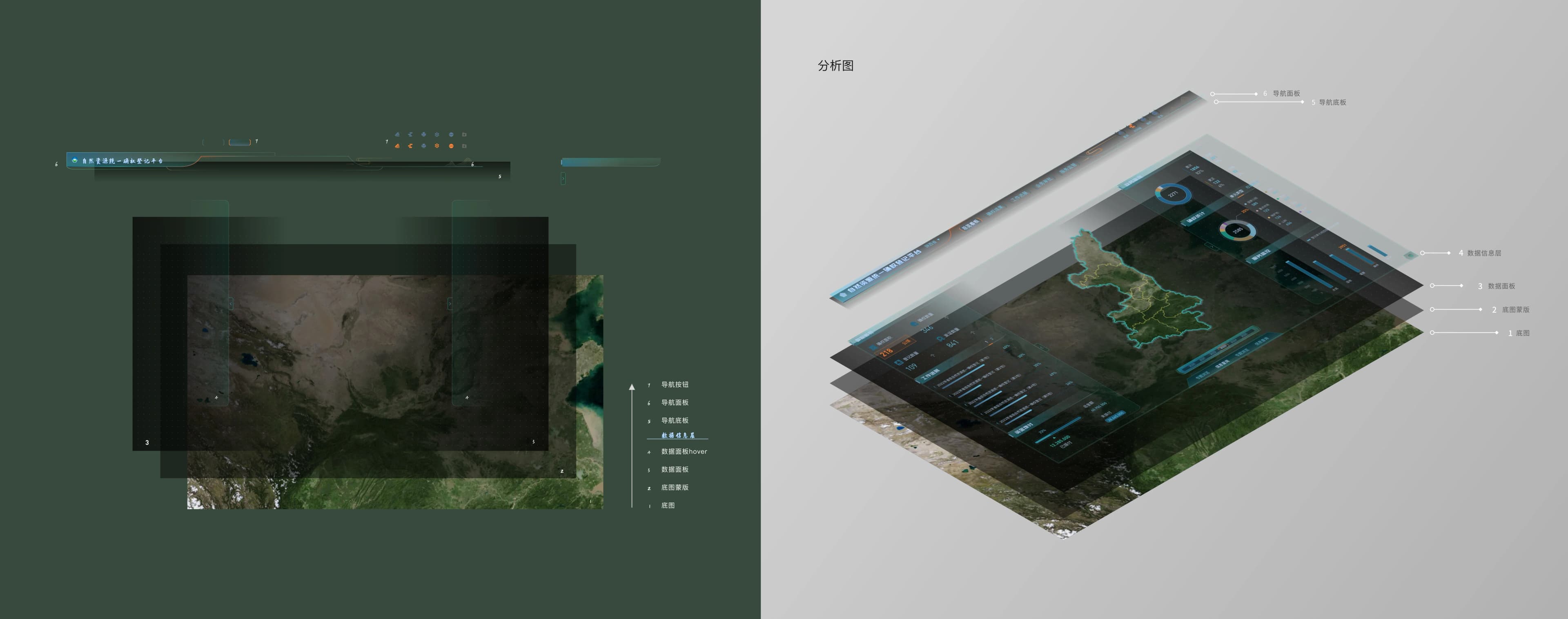
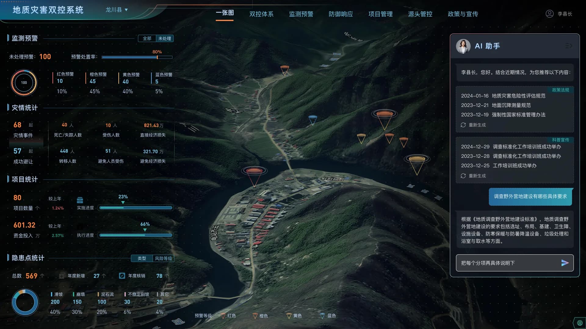
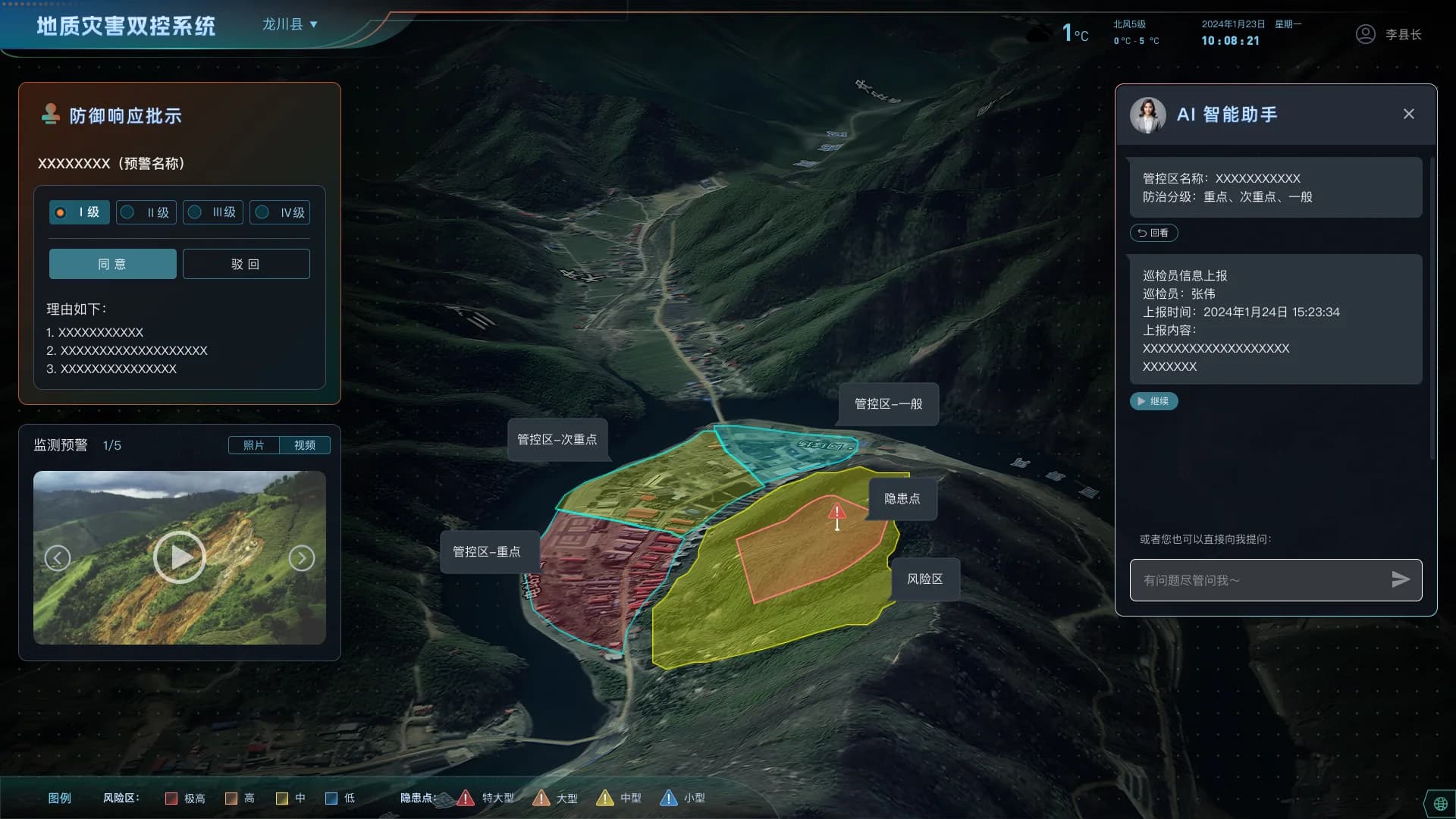
In the geological-hazard scenario, the map holds risk objects, monitoring information, alert levels, and response actions together. Information layering first makes the situation readable; key areas, field media, approval decisions, and the AI assistant then return to their concrete spatial locations for follow-through.
06 / DESIGN METHOD
Product principles
The system established a reusable approach to spatial products:
- Use spatial objects as the shared entry point for information and tasks
- Use one stable work surface for data selection, analysis results, and specialist tools
- Reuse GIS capability through standardized components instead of rebuilding interaction rules
- Close the work from judgment to response with states, records, and accountable actions
Next Case
From Data to Agent→